Water Cycle Explained: Stages, Diagram, Processes, Importance
What Is the Water Cycle? Definition and Fundamentals The water cycle , also known as the hydrologic cycle , is the continuous, natural process by which water circulates through Earth's atmosphere,...
What Is the Water Cycle?
Definition and Fundamentals
The water cycle, also known as the hydrologic cycle, is the continuous, natural process by which water circulates through Earth's atmosphere, land, and oceans. It describes the perpetual movement of water molecules from the surface of the Earth into the atmosphere and back again — driven primarily by solar energy and gravity. Unlike many natural processes that have a clear beginning and end, the water cycle is genuinely circular: there is no starting point and no finish line. Every raindrop that falls today may have once been part of an ancient glacier, a tropical ocean, or the bloodstream of a dinosaur. Understanding this cycle means understanding one of the most fundamental engines of life on Earth.
At its core, the water cycle operates through a series of physical and chemical transformations. Water changes state — from liquid to vapor to ice and back — as it moves through different environments. The total amount of water on Earth remains essentially constant at roughly 1.386 billion cubic kilometers, but its distribution is in constant flux. About 97.5% of that water is saltwater held in the oceans, while only 2.5% is freshwater. Of that freshwater, approximately 68.7% is locked in glaciers and ice caps, leaving less than 1% readily accessible to humans in rivers, lakes, and shallow groundwater. The cycle is what makes even that small fraction continuously available, replenishing rivers and aquifers across the globe.
The scientific study of water's movement on Earth dates back centuries. The ancient Greeks, including Aristotle, speculated about the origins of rivers and rainfall, though their explanations mixed observation with mythology. It was not until the 17th century that naturalists like Pierre Perrault and Edme Mariotte began conducting quantitative measurements — comparing rainfall to river discharge in the Seine basin — and established the first empirical foundations of hydrology. By the 19th century, the hydrologic cycle was formalized as a scientific framework, and today it underpins disciplines ranging from meteorology and climatology to ecology and civil engineering. Without a working knowledge of the water cycle, modern water resource management would be essentially impossible.
One of the most important things to appreciate about the water cycle is that it is not a simple, linear conveyor belt. It is a complex, branching network of pathways. A water molecule evaporating from the Pacific Ocean might travel as water vapor for days, crossing mountain ranges and continents before condensing into a cloud and precipitating as snow on the Himalayas. That snow might then remain frozen for decades before melting and feeding a river that irrigates farmland in Bangladesh. At every stage, the water interacts with soil, vegetation, the atmosphere, and living organisms. This complexity is precisely why Earth's climate is so sensitive to disruptions — interfering with one part of the cycle sends ripples through all the others.
Role of the Hydrologic Cycle
The hydrologic cycle plays a role that goes far beyond simply moving water from place to place. It is a primary driver of weather and climate, transferring heat energy around the planet as water evaporates, rises, condenses, and falls. When water evaporates, it absorbs latent heat from the surface — effectively cooling that surface. When it later condenses in the atmosphere, it releases that stored heat, warming the surrounding air and driving atmospheric circulation patterns. This process is responsible for much of the energy that powers hurricanes, thunderstorms, and the global wind systems that sailors and aviators have relied upon for centuries.
The cycle also performs essential chemical work, transporting dissolved minerals, nutrients, and even pollutants across vast distances. As water flows over and through rock and soil, it picks up minerals through chemical weathering — a process that has, over geological time, shaped the chemistry of the ocean itself. Rivers carry dissolved calcium, magnesium, and bicarbonate from inland rock formations to the sea, contributing to the mineral balance that marine life depends on. The cycle also connects terrestrial ecosystems to aquatic ones in profound ways: the nitrogen that falls in rainfall, the organic carbon carried by runoff, and the sediments transported by flooding rivers all link the fate of forests, grasslands, and wetlands to the movement of water.
From a societal perspective, the hydrologic cycle is the foundation of freshwater availability. Every glass of water drawn from a tap, every irrigation canal feeding a farm, and every hydroelectric dam generating power depends on the cycle reliably delivering precipitation and replenishing groundwater. According to the United Nations, approximately 2 billion people currently live in countries experiencing high water stress — a statistic that reflects, in large part, how human activity has disrupted or placed excessive demands on the natural water cycle. Understanding how the cycle works is therefore not just an academic exercise; it is a prerequisite for solving some of the most urgent challenges facing humanity in the 21st century.
Why Study the Water Cycle
Studying the water cycle gives scientists the tools to predict droughts, floods, and the long-term impacts of climate change. Modern climate models — such as those used by the Intergovernmental Panel on Climate Change (IPCC) — are built on detailed mathematical representations of the water cycle, including how evaporation rates change with temperature, how vegetation alters transpiration, and how clouds form and dissipate. These models are our best tools for anticipating how a warming atmosphere will alter precipitation patterns, glacier retreat, and sea-level rise over the coming decades. Without rigorous understanding of hydrologic processes, those predictions would be little more than guesswork.
For environmental engineers and water managers, knowledge of the cycle is indispensable for designing infrastructure that can handle the natural variability in water supply. A reservoir must be sized not just for average rainfall but for the extremes that the cycle can produce — years of drought followed by catastrophic flooding. The 2011 Tōhoku earthquake and tsunami in Japan, the 2010 Pakistan floods, and the prolonged California drought of 2011–2017 all demonstrate how critical it is to understand and respect the dynamics of the water cycle when planning cities, agriculture, and energy systems. Each of these events caused enormous human suffering that was, at least in part, exacerbated by inadequate understanding or mismanagement of water resources.
Stages of the Water Cycle
Overview of Main Stages
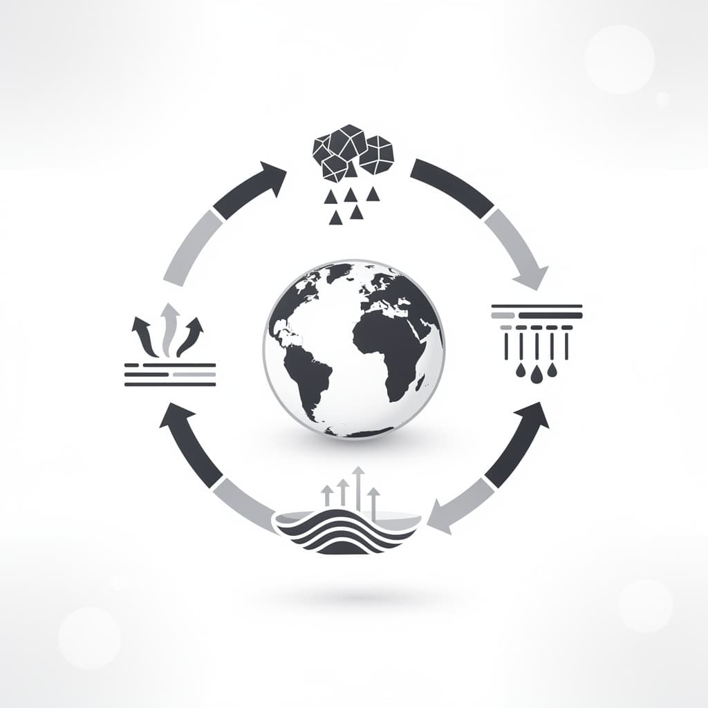
The water cycle is conventionally broken into several key stages that together describe the full journey of a water molecule through the Earth system. These stages include evaporation, transpiration, condensation, precipitation, surface runoff, infiltration, and groundwater flow. Some textbooks also add sublimation — the direct conversion of ice into water vapor without passing through the liquid phase — as a distinct stage, especially relevant in polar regions and high mountain environments. While these stages are often listed in a linear sequence for educational purposes, in reality they occur simultaneously in different parts of the world at any given moment, overlapping and interacting in complex ways.
The stages can be broadly grouped into two major phases: the atmospheric phase and the terrestrial phase. In the atmospheric phase, water moves upward and through the air — evaporating from water bodies, rising as water vapor, forming clouds through condensation, and falling back to Earth as precipitation. In the terrestrial phase, water moves across and through the land — flowing as surface runoff into rivers and lakes, soaking into soil through infiltration, and being drawn up by plant roots before being released back into the atmosphere through transpiration. These two phases are tightly coupled: the atmosphere depends on the land and ocean as sources of moisture, while the land depends on the atmosphere to deliver precipitation.
A useful way to appreciate the scale of these stages is through numbers. Each year, approximately 496,000 cubic kilometers of water evaporate from Earth's surface — about 425,000 km³ from the oceans and 71,000 km³ from land surfaces (including transpiration from plants). This enormous volume of water vapor rises into the atmosphere, travels on wind currents, and eventually precipitates back down: roughly 385,000 km³ falls directly back into the ocean, while 111,000 km³ falls on land. The difference between land precipitation and evapotranspiration — approximately 40,000 km³ per year — becomes the runoff that fills the world's rivers and recharges its aquifers. This budget must balance over the long term, and tracking imbalances is how scientists detect changes in the global water cycle.
Hydrologic Cycle Steps
Following a single water molecule through the cycle illustrates the sequence of steps with satisfying clarity. Imagine a molecule sitting in the surface layer of the Atlantic Ocean on a sunny afternoon. Solar radiation heats the water, increasing the kinetic energy of individual molecules until some near the surface break free of liquid water's hydrogen-bond network and escape into the air as water vapor. This is evaporation. The molecule is now part of the atmosphere, carried upward by convective currents of warm, buoyant air. As it rises, the surrounding air cools, and eventually the vapor reaches a level where the temperature drops below the dew point — the temperature at which air becomes saturated with water vapor. At this point, condensation begins, and the molecule joins millions of others in forming the tiny droplets that make up a cloud.
Inside the cloud, those tiny droplets grow by collecting more vapor and by colliding with other droplets in a process called coalescence. When droplets become heavy enough that updraft winds can no longer support them, they fall as precipitation — in this case, perhaps as rain over a European coastline. The raindrop strikes the soil, and the molecule now has several possible paths. It might flow quickly across the surface into a stream (runoff), it might soak into the soil (infiltration) and be absorbed by plant roots (only to be transpired back into the air hours or days later), or it might continue percolating downward through porous rock until it reaches a saturated zone and becomes part of groundwater. From groundwater, the molecule may slowly migrate toward a river or coastal spring over years or even centuries before re-entering the ocean.
The Endless Loop
What makes the cycle "endless" is the absence of any destruction or creation of water molecules in the process. Water is not consumed by the cycle; it is continuously redistributed. The same water molecules that fell as rain on ancient Rome, nourished the forests of the Amazon, and filled the wells of medieval China are still circulating through the system today. This has profound philosophical and ecological implications: water is simultaneously a local resource and a global commons, shared across time and space by every organism that has ever lived. It also means that pollution introduced into the cycle — whether by agricultural chemicals, industrial waste, or atmospheric emissions — can travel extraordinary distances and persist for generations.
The residence time of water in different reservoirs illustrates just how varied the pace of the cycle can be. A water molecule in the atmosphere has an average residence time of about 9 days — the entire atmospheric portion of the cycle is rapid and vigorous. In a river, residence time is typically 2–6 months. In a shallow lake, it might be years. In deep groundwater aquifers, such as the Ogallala Aquifer beneath the American Great Plains, water that fell as rain during the last Ice Age can have residence times of thousands of years. In Antarctic ice sheets, the residence time can exceed 100,000 years. Understanding these different timescales is crucial because it determines how quickly a reservoir can recover from depletion or pollution — and how quickly changes in climate will be felt in different parts of the cycle.
Evaporation and Condensation
How Evaporation Occurs
Evaporation is the process by which liquid water at or near the surface converts into water vapor and enters the atmosphere. It is fundamentally a molecular phenomenon: at any given temperature, the molecules in a liquid are in constant, random motion, and the fastest-moving molecules near the surface occasionally have enough kinetic energy to overcome the attractive forces holding them in the liquid phase and escape into the air above. This is why evaporation occurs at temperatures well below water's boiling point — it does not require every molecule to reach 100°C, only the most energetic ones near the surface. The rate of evaporation depends on temperature, wind speed, the humidity of the overlying air, and the surface area of the water body.
The energy required to convert liquid water to vapor is substantial. The latent heat of vaporization of water is approximately 2,260 kilojoules per kilogram at 100°C, and about 2,450 kJ/kg at typical Earth surface temperatures around 20°C. This means that evaporation is an enormously effective cooling mechanism — it is why sweating cools the body, why coastal cities tend to have milder climates than inland ones, and why the evaporation of ocean water is the primary mechanism by which tropical heat is transported toward the poles. In fact, the global latent heat flux — the energy transported from Earth's surface to the atmosphere through evaporation — is estimated at roughly 80 watts per square meter globally, making it one of the dominant terms in Earth's energy budget.
Transpiration — the release of water vapor from plant leaves through tiny pores called stomata — is closely related to evaporation and is often combined with it in the term evapotranspiration. Plants draw water up from the soil through their roots and release it into the atmosphere as a byproduct of photosynthesis and as a mechanism for nutrient transport. The Amazon rainforest, for instance, transpires so much water that it effectively creates its own rainfall — moisture released by trees in the eastern Amazon travels westward on wind currents and falls as rain in the western Amazon, in a phenomenon that Brazilian researchers have called "flying rivers." Deforestation disrupts this feedback loop, reducing transpiration and potentially causing regional droughts that further degrade the forest — a stark example of how human activity can short-circuit the water cycle.
Condensation Process Details
Condensation is the reverse of evaporation: it is the process by which water vapor in the atmosphere converts back into liquid water droplets. Condensation occurs when moist air is cooled below its dew point temperature, causing the air to become saturated and water vapor to begin nucleating on tiny particles called condensation nuclei. These nuclei can be dust particles, sea salt crystals, pollen grains, or even combustion particles from human industry. Without condensation nuclei, supersaturated air can exist without clouds forming — a phenomenon that has been studied in laboratory settings. In the atmosphere, however, condensation nuclei are virtually always present, which is why clouds form readily whenever air is cooled sufficiently.
The formation of clouds is one of the most visually striking products of condensation, but it occurs in several different ways depending on how the air is cooled. Adiabatic cooling — the cooling that occurs when air rises and expands — is responsible for the towering cumulonimbus clouds of thunderstorms and the flat-bottomed cumulus clouds of fair weather. As warm air near the surface rises (driven by solar heating or forced upward over mountains), it cools at the dry adiabatic lapse rate of about 9.8°C per kilometer until it reaches the dew point, at which elevation cloud base forms. Advection fog and radiation fog, in contrast, result from air being cooled by contact with a cold surface, rather than by rising. The type of condensation process determines the character of the clouds and, ultimately, the type of precipitation that will follow.
Factors Influencing These Stages
Several environmental factors profoundly influence both evaporation and condensation rates and, consequently, the pace of the entire water cycle. Temperature is the most fundamental: warmer temperatures increase the kinetic energy of water molecules, accelerating evaporation, and simultaneously allow the atmosphere to hold more water vapor (described by the Clausius-Clapeyron equation, which shows that saturation vapor pressure increases by roughly 7% for every 1°C of warming). This means that a warming climate does not simply redistribute water — it intensifies the entire cycle. More evaporation means more moisture in the atmosphere, which means heavier rainfall events when that moisture is eventually released, even if total annual precipitation in some regions decreases.
Wind speed affects evaporation by replacing humid air near the water surface with drier air, maintaining a steep humidity gradient that draws water vapor upward more quickly. This is why windy days cause laundry to dry faster and why coastal regions with onshore winds tend to have higher evaporation rates than still, sheltered lakes. Relative humidity, conversely, acts as a brake on evaporation: when the air is already saturated with water vapor, evaporation slows dramatically, which is why hot, humid days feel so oppressive — sweat evaporates slowly and the body cannot cool efficiently. These interdependencies mean that changes in land cover, urbanization, and atmospheric composition can all alter local evaporation and condensation regimes in ways that have cascading effects on regional climate and water availability.
Precipitation and Collection
Types of Precipitation
Precipitation is the general term for any form of water that falls from the atmosphere to Earth's surface. The most familiar form is rain — liquid water droplets that have grown large enough in a cloud to overcome updraft winds and fall under gravity. But precipitation takes many other forms depending on atmospheric temperature profiles at different altitudes. Snow forms when temperatures throughout the atmosphere are below freezing and water vapor deposits directly onto ice crystals, growing them into the characteristic hexagonal shapes through a process called deposition. Sleet occurs when raindrops pass through a layer of freezing air and solidify before reaching the ground. Freezing rain occurs when rain falls through a very shallow layer of freezing air and does not have time to freeze until it contacts a surface, coating everything in a layer of ice. Hail forms inside powerful thunderstorms when updrafts carry water droplets repeatedly into freezing zones, building up concentric layers of ice until the stone is heavy enough to fall.
The geographical and seasonal distribution of precipitation is highly uneven and is one of the primary determinants of ecosystem type. The equatorial zone receives abundant rainfall year-round because the intense solar heating at low latitudes drives strong convection, creating the persistent thunderstorm activity of the Intertropical Convergence Zone (ITCZ). The subtropical high-pressure zones around 30° latitude are persistently dry, which is why the world's great deserts — the Sahara, Arabian, Australian, and Atacama — are located in these latitudinal bands. Mid-latitudes experience highly variable precipitation driven by the passage of frontal systems — the boundaries between warm and cold air masses — which are responsible for most of the rain and snow that falls over Europe, North America, and East Asia.
Runoff and Infiltration
When precipitation reaches the surface, two primary pathways determine its fate: it either flows across the surface as runoff or soaks into the ground through infiltration. The relative balance between these two pathways depends on the intensity of rainfall, the permeability of the soil, the slope of the terrain, the presence of vegetation, and whether the soil is already saturated. Sandy soils have high permeability and can absorb rainfall quickly; clay soils have low permeability and generate runoff more readily. Frozen or compacted soils behave almost like impermeable surfaces — a key reason why rapid snowmelt in spring can cause severe flooding even in landscapes that normally absorb precipitation efficiently.
Surface runoff collects into rills, then streams, then rivers, eventually draining to the ocean or to interior basins such as the Caspian Sea or the Great Basin of North America. The network of streams and rivers that drains a particular area is called a watershed or drainage basin. Understanding watershed hydrology is critical for flood prediction and water supply management. The Amazon River Basin, the world's largest drainage basin at approximately 7.05 million square kilometers, discharges about 209,000 cubic meters of water per second into the Atlantic Ocean — roughly 20% of all freshwater discharged by rivers globally. Changes in land use within a watershed — particularly deforestation and urbanization — can dramatically increase runoff rates, causing more frequent flooding and reducing groundwater recharge.
Groundwater Recharge
Water that infiltrates the soil enters a complex subsurface environment. The uppermost layer of soil is the unsaturated zone or vadose zone, where water fills only some of the pore spaces between soil particles. Below this lies the saturated zone, where all pore spaces are filled with water — this is groundwater, and the upper surface of the saturated zone is called the water table. The process by which water moves downward from the surface to join this saturated zone is called groundwater recharge. It is a relatively slow process in many environments, moving at rates of millimeters to meters per year, though it can be faster through fractures in bedrock or permeable gravel layers.
Groundwater is stored in aquifers — permeable rock formations that can hold and transmit significant quantities of water. Aquifers are among humanity's most important freshwater resources: globally, about 2 billion people depend on groundwater for their drinking water supply, and roughly 40% of irrigation water worldwide comes from aquifers. The critical importance of groundwater recharge lies in the fact that many aquifers are being depleted by pumping far faster than they are being recharged by the water cycle. The Ogallala Aquifer, which underlies about 450,000 square kilometers of the central United States and supports irrigation of about 30% of all groundwater-irrigated agricultural land in the country, is being drawn down at rates estimated at 10 to 100 times the natural recharge rate — a trajectory that poses severe long-term food security challenges.
Water Cycle Diagram Guide
Simple Water Cycle Diagram
A well-constructed water cycle diagram is one of the most effective educational tools for conveying the interconnectedness of hydrologic processes. The simplest version — appropriate for introductory education — typically shows a landscape cross-section featuring an ocean or large body of water on one side, mountains in the center, and a land area with vegetation and a river flowing back to the ocean. Curved arrows trace the journey of water upward as vapor from the ocean surface, across as clouds, downward as precipitation on the mountains, and back along the surface as river runoff. Such a diagram immediately communicates the essential circular nature of the process and provides a spatial context that helps learners anchor abstract concepts to physical geography.
Even a simple diagram should clearly distinguish between the main reservoirs — ocean, atmosphere, land surface, vegetation, and subsurface — and the fluxes connecting them. Color coding is particularly helpful: blue for water in its liquid form, white or gray for clouds and vapor, and perhaps green for vegetation to highlight the role of transpiration. The arrows connecting components should ideally vary in thickness to indicate the relative magnitude of each flux — showing, for instance, that ocean evaporation is a far larger flux than transpiration from land vegetation, even though both contribute to atmospheric moisture. A diagram that accurately represents these relative magnitudes trains the viewer's intuition in a way that a list of facts cannot.
Labeled Diagram Breakdown
A more detailed, labeled water cycle diagram will typically include all of the following components with their correct technical labels:
- Solar radiation — the energy input that drives evaporation and atmospheric circulation
- Evaporation — upward-pointing arrows from the ocean and lake surfaces
- Transpiration — upward arrows from vegetation, often combined with evaporation as "evapotranspiration"
- Sublimation — arrows rising from glaciers or snow pack directly to water vapor
- Water vapor transport — horizontal arrows showing wind-driven moisture movement through the atmosphere
- Condensation — the formation of cloud droplets indicated at cloud level
- Precipitation — downward arrows for rain and snow
- Surface runoff — arrows following the land surface toward rivers
- Infiltration — downward arrows into the soil layer
- Groundwater flow — lateral arrows in the subsurface moving toward rivers or the ocean
- River discharge — an arrow from the river back into the ocean, completing the loop
- Snowmelt — arrows from mountain snow pack leading to rivers
Each label in a well-designed diagram should be accompanied by a brief quantitative note where space permits — for instance, noting that approximately 86% of global evaporation comes from the ocean surface, or that the average water vapor in the atmosphere has a residence time of about 9 days. These numbers transform a purely qualitative picture into a quantitatively calibrated one, helping learners develop a sense of the magnitudes involved. Cross-referencing the diagram with a water balance table — listing major global reservoirs and their volumes, and annual fluxes between them — completes the picture.
Interactive Diagram Tips
Digital and interactive water cycle diagrams offer significant educational advantages over static images by allowing learners to explore cause-and-effect relationships dynamically. An effective interactive diagram might allow users to adjust a slider for global temperature and then observe how evaporation rates, cloud cover, and precipitation patterns change in response — directly demonstrating the Clausius-Clapeyron amplification of the water cycle under warming. Similarly, users could toggle deforestation of a watershed and watch how runoff increases and groundwater recharge decreases. These interactive features transform the diagram from a passive reference into an active learning tool that builds systems-thinking skills.
For educators developing or selecting interactive diagrams, several quality criteria are worth applying. First, the diagram should be scientifically accurate — avoiding common oversimplifications such as showing water moving in a simple clockwise loop that implies all water follows the same path. Second, it should represent the full range of timescales involved, perhaps by including a "time lapse" feature that shows how different water molecules travel through the cycle at vastly different speeds. Third, it should connect to real-world data where possible — linking the evaporation arrow, for instance, to a live feed of sea surface temperature data, or connecting the precipitation arrow to historical rainfall records for specific locations. These connections between the diagram and real-world observations deepen understanding and reinforce the relevance of the science.
Water Cycle Process Explained
Step-by-Step Process Guide
To understand the water cycle process completely, it helps to trace the path of water through a full, detailed sequence of steps while keeping in mind that these steps occur simultaneously across the globe. The process begins with solar heating of surface water: the sun emits electromagnetic radiation that is partially absorbed by the upper layer of the ocean, warming it and imparting kinetic energy to water molecules. At the air-water interface, the most energetic molecules escape their hydrogen bonds and enter the atmosphere as water vapor — a colorless, odorless gas. The rate of this evaporation is governed by the vapor pressure gradient between the water surface and the overlying air; when the air is dry, evaporation proceeds quickly; when the air is saturated, it slows nearly to a halt.
As water vapor enters the atmosphere, it is mixed upward and horizontally by turbulent air motions. Parcels of warm, moist air are buoyant relative to cooler, drier air and rise by convection, carrying their water vapor cargo to higher altitudes. As a rising parcel expands adiabatically, its temperature drops at the dry adiabatic lapse rate until the dew point is reached and condensation begins. The resulting cloud droplets are extraordinarily small — typically 10–20 micrometers in diameter — and are kept aloft by even gentle updrafts. For precipitation to form, these droplets must grow by several orders of magnitude in mass. This growth occurs through two main mechanisms: collision-coalescence, in which droplets collide and merge (dominant in warm clouds), and the Bergeron process, in which ice crystals in mixed-phase clouds grow at the expense of supercooled water droplets (dominant in cold clouds at middle and high latitudes).
Once precipitation reaches the surface, the local characteristics of the landscape determine what happens next. Over an urban surface covered with impermeable concrete and asphalt, nearly all precipitation becomes runoff, rushing into storm drains and potentially causing flash flooding. Over a healthy, vegetated soil, a significant fraction is intercepted by plant canopies (where it may evaporate directly without reaching the ground — a process called interception loss), and much of what does reach the soil infiltrates. Below the soil, water moves downward through the vadose zone, held against gravity by surface tension in a form called capillary water, until it either drains to the water table or is extracted by plant roots. Water reaching the saturated zone joins the local groundwater system, moving laterally (and often extremely slowly) toward discharge points in streams, rivers, springs, or directly into the ocean — completing the terrestrial portion of the cycle.
Real-World Examples
Few places on Earth illustrate the water cycle more vividly than the Indian subcontinent during the South Asian monsoon. Each year, from roughly June to September, the Arabian Sea and Bay of Bengal supply enormous quantities of water vapor to the atmosphere as the ocean surface is heated by the summer sun. This moisture-laden air is drawn northward by the thermal low-pressure system that develops over the heating Thar Desert and Indo-Gangetic Plain. As the moist air reaches the Western Ghats and the foothills of the Himalayas, it is forced upward orographically, cooling and condensing into some of the most intense rainfall on Earth. Mawsynram in northeastern India, which receives approximately 11,871 mm of rainfall annually, holds the record for the world's highest average precipitation — nearly all of it delivered in just four monsoon months.
The Colorado River Basin in the American West provides a sobering example of a water cycle under pressure from human demand. The river's flow is derived almost entirely from snowmelt in the Rocky Mountains — a form of natural water storage that buffers the dry Southwest against the seasonal concentration of precipitation. Since the early 20th century, an elaborate system of dams, reservoirs, and diversions has been built to capture and redistribute this flow to cities and farms across seven states and Mexico. But over recent decades, rising temperatures have reduced snowpack, accelerated evaporation from reservoirs, and decreased the river's overall discharge, while simultaneously growing populations and expanding irrigation have increased demand. By 2022, Lake Mead — the nation's largest reservoir — had dropped to just 27% of its capacity, triggering unprecedented federal water shortage declarations. This is the water cycle in crisis.
Common Misconceptions
One of the most pervasive misconceptions about the water cycle is that it moves water in a simple, predictable loop: ocean → cloud → rain → river → ocean. While this simplified picture has pedagogical value, it obscures the enormous variability in pathways and timescales involved. Water does not necessarily travel from ocean to cloud to rain to river in any fixed time frame — a water molecule might cycle through the atmosphere and back to the ocean surface repeatedly in a matter of weeks, or it might be locked in a glacier for tens of thousands of years before re-entering the active cycle. Recognizing this variability is essential for understanding why different parts of the cycle respond to climate change at such different rates and why depletion of some water resources is effectively irreversible on human timescales.
Another common misconception is that clouds are made of water vapor. In fact, water vapor is invisible — it is a true gas mixed into the air just like nitrogen or oxygen. What we see as clouds are made of liquid water droplets or ice crystals that have already undergone condensation. The white color of clouds results from the scattering of visible light by these tiny droplets in a process called Mie scattering. When a cloud is thick enough, it absorbs and scatters so much light that it appears gray or dark — the so-called "dark cloud before a storm" is simply a very thick cloud in which less sunlight penetrates to the base. Understanding the distinction between water vapor and cloud droplets is also important for understanding why clear air can hold enormous amounts of water — tropical air at 30°C can hold up to about 30 grams of water vapor per kilogram of air — and why humidity, not cloud cover, is the key indicator of atmospheric moisture content.
Water Cycle for Kids
Easy Explanation for Children
For young learners, the water cycle can be introduced as the story of a water drop going on an incredible adventure — one that has no beginning and no end. Imagine a tiny water drop named Wren sitting in the ocean on a sunny morning. The sun shines down and warms Wren up until, suddenly, she becomes so light and energetic that she floats up into the air as an invisible gas called water vapor. High in the sky, Wren gets cold and joins millions of other water drops to form a fluffy white cloud. When the cloud gets full of water drops, they become too heavy to stay up, and down they fall as rain. Wren lands on a mountain, trickles into a stream, follows the river all the way back to the ocean, and the whole adventure begins again! This simple story captures the essential sequence — evaporation, condensation, precipitation, and flow — in terms that a child of 6 or 7 years can follow and remember.
As children grow older, the explanation can be expanded to incorporate the names of each stage and the reasons behind them. Evaporation can be demonstrated concretely by leaving a puddle of water on a warm day and watching it disappear — where did it go? Into the air, as invisible water vapor! Condensation becomes tangible on a cold glass of lemonade on a humid day: the water on the outside of the glass did not leak through the glass — it came out of the air, condensing on the cold surface just as water vapor condenses on cold air to form clouds. Precipitation is familiar to every child who has ever been caught in the rain or seen snow. And runoff can be observed by watching where puddles go after a rainstorm — into gutters, down drains, or into grassy areas where it soaks into the ground.
Teaching children about the water cycle also provides an early opportunity to build environmental literacy. Once a child understands that the water they drink has been cycling through Earth's oceans, atmosphere, and land for billions of years, they begin to appreciate water not as a limitless commodity that comes from a tap, but as a precious part of a global system that needs to be protected. Simple messages about conserving water — turning off the tap while brushing teeth, not polluting rivers or streams, appreciating rainfall — take on much deeper meaning when a child understands the cycle that delivers that water and the effort required to maintain it. Environmental education rooted in genuine scientific understanding, even at a simplified level, tends to produce more durable attitudes and behaviors than instruction based purely on rules or moral injunctions.
Fun Facts and Activities
One of the most engaging facts for young learners is that the water they drink today may have once been part of a dinosaur. Since water is neither created nor destroyed in the water cycle, the same molecules have been circulating for billions of years. The Earth's water was primarily delivered by asteroid and comet impacts early in the planet's history, and those same molecules — though rearranged through countless chemical and physical transformations — are still here today. The next glass of water a child drinks might contain molecules that once flowed through the Nile River in ancient Egypt, fell as snow on the Andes during the last Ice Age, or evaporated from a Mesozoic ocean while pterosaurs flew overhead. Framed this way, something as mundane as a drink of water becomes genuinely wondrous.
A classic classroom activity that beautifully demonstrates the full water cycle in miniature is the "water cycle in a bag" experiment. A sealed plastic bag with a small amount of water and a black marker drawing of clouds, rain, and a lake is taped to a sunny window. Over the course of the day, the water evaporates (warms and turns to vapor), condenses on the cooler sides of the bag (forming visible droplets), and "rains" back down to the bottom. This self-contained demonstration makes abstract processes immediately visual and tangible — children can observe condensation droplets forming and growing in real time. Other excellent activities include building a simple rain gauge to measure local precipitation, growing plants in sealed terrariums to observe evapotranspiration, and mapping the local watershed by tracing where rainwater that falls on the schoolyard ultimately drains to.
Kid-Friendly Diagram
A child-friendly water cycle diagram differs from an adult scientific version primarily in its visual style, vocabulary, and complexity. Rather than technical arrows labeled with flux values in km³/year, a kid-friendly diagram uses bright colors, illustrated characters, and simple action words — "water goes up," "water makes clouds," "water falls down," "water flows back." The landscape should be recognizable and relatable — a cartoon sun in the corner, blue wiggly lines for rivers, puffy white clouds, and cheerful raindrops with faces. Key words like "evaporation," "condensation," and "precipitation" can still be introduced alongside simpler synonyms ("water goes up into the air," "water turns into clouds," "rain falls from the clouds"), building vocabulary gradually rather than overwhelming the learner at the outset.
The most effective kid-friendly diagrams are ones that invite interaction rather than passive observation. Diagrams that children can label themselves, trace with their fingers, or use as the basis for a storytelling exercise are far more memorable than ones meant to be copied into a notebook. Encouraging children to add their own elements — a house, their school, a garden — and then trace how water moves through their own local environment personalizes the cycle and makes it relevant to their lived experience. This kind of personalized, place-based learning is particularly effective for building genuine environmental understanding and stewardship values in young people, connecting the global scientific concept to the specific puddles, streams, and taps that form the water world a child actually knows.
Importance of the Water Cycle
Ecosystem and Climate Impact
The water cycle is arguably the single most important biogeochemical cycle on Earth, and its influence on ecosystems and climate cannot be overstated. Terrestrial biomes — from tropical rainforests to arctic tundra — are defined largely by the quantity, seasonality, and form of precipitation they receive. The lush diversity of a tropical rainforest depends entirely on the cycle reliably delivering several meters of rainfall per year, while the sparse but perfectly adapted life of a desert ecosystem has evolved around the near-total absence of that delivery. The water cycle does not merely support these ecosystems — it creates and maintains them, shapes their soils, determines their plant communities, and governs the abundance and distribution of their animal life.
At the global climate scale, the water cycle and the carbon cycle are intimately linked feedbacks within the Earth system. Vegetation draws water from the soil and releases it through transpiration, but simultaneously draws carbon dioxide from the atmosphere through photosynthesis. When the water cycle is disrupted — by drought, deforestation, or changes in precipitation patterns — carbon uptake by vegetation is also affected. Droughts stress forests, reducing their photosynthesis and causing some trees to die, releasing their stored carbon back into the atmosphere. The Amazon droughts of 2005 and 2010 were estimated to have caused carbon releases of 1.6 billion and 2.2 billion tonnes respectively — comparable to the annual emissions of major industrialized nations — illustrating how the water cycle and carbon cycle are coupled in a complex feedback system that amplifies or moderates climate change.
Ocean circulation patterns, which are fundamentally driven by differences in temperature and salinity, are also profoundly affected by the water cycle. Evaporation from the ocean surface increases the salinity of surface water (leaving the salt behind), making it denser and more likely to sink — a key component of the thermohaline circulation, or "global ocean conveyor belt." This circulation transports heat from the tropics toward the poles, moderating the climate of regions such as Northern Europe (which is dramatically warmer than other areas at comparable latitudes). Increases in freshwater input to the North Atlantic from glacial melt and increased precipitation — both consequences of a warming climate — have the potential to weaken this circulation, with potentially severe consequences for European and North American climates. The water cycle, in this way, connects individual glaciers in Greenland to winter temperatures in London and Paris.
Sustaining Life on Earth
Life as we know it is impossible without a functioning water cycle. At the cellular level, water is the universal solvent in which biochemical reactions occur, the medium through which nutrients and waste products are transported, and a direct participant in metabolic reactions including photosynthesis and hydrolysis. At the ecosystem level, freshwater delivered by the cycle supports the primary productivity — the photosynthetic conversion of solar energy into organic matter — that forms the base of nearly every food web on land. Rivers, lakes, and wetlands support extraordinary concentrations of biodiversity; wetlands alone, which cover only about 6% of Earth's surface, are estimated to support approximately 40% of the world's species.
The cycle also sustains the soil systems that underpin agriculture and terrestrial ecosystems. Rainfall drives the weathering of parent rock into soil minerals, transports organic matter through soil profiles, controls soil aeration and microbial activity, and delivers the water that plants need for growth. The fertile river valley civilizations of history — the Nile, Tigris-Euphrates, Indus, and Yellow River basins — arose precisely because the water cycle delivered annual floods that deposited rich sediment, recharging both soil nutrients and groundwater. Modern agriculture, which feeds 8 billion people, depends on the cycle to supply irrigation water, regulate temperature extremes, and maintain the soil moisture conditions that allow crops to grow. Any significant disruption to the regional water cycle — whether through climate change, deforestation, or aquifer depletion — represents a direct threat to food security at continental scale.
Human health is also directly dependent on the water cycle in ways that extend beyond simple hydration. Waterborne diseases — including cholera, typhoid, and dysentery — are transmitted through contaminated water sources, and the incidence of these diseases is closely tied to the quality of water delivered by the cycle. Adequate rainfall and river flow dilute pollutants and flush pathogens; drought conditions concentrate both, increasing disease risk. The relationship between the water cycle and vector-borne diseases such as malaria is similarly complex: standing water created by heavy rainfall provides breeding habitat for Anopheles mosquitoes, while drought can also concentrate mosquito breeding in remaining water bodies. These health connections underscore that the water cycle is not only an environmental phenomenon but a public health and humanitarian one — a fact that has become starkly apparent in the context of climate change and its impacts on global disease burden.
Human Activities and Conservation
Human civilization has modified the water cycle in profound ways, many of them detrimental. Land use change — particularly the conversion of forests to agriculture and the expansion of impervious urban surfaces — alters the partitioning of precipitation between runoff, infiltration, and evapotranspiration, reducing groundwater recharge and increasing flood risk. The global extraction of groundwater for irrigation and municipal supply currently exceeds natural recharge rates in many major aquifer systems, effectively "mining" water that accumulated over thousands to millions of years. The construction of dams has fundamentally altered river flow regimes, reducing the downstream delivery of sediment and nutrients that sustain river deltas and coastal ecosystems. Industrial and agricultural pollution has contaminated surface water and groundwater resources, rendering portions of the water cycle's output unusable for human consumption without costly treatment.
Climate change is acting as a global amplifier of these existing stresses on the water cycle. A warming atmosphere holds more water vapor, intensifying the cycle overall: the most severe precipitation events are becoming more intense, while regions in the subtropics and interiors of continents are experiencing longer and more severe droughts. Mountain snowpack — which acts as a natural reservoir storing water through the winter and releasing it gradually through spring and summer — is declining at alarming rates across the Himalayas, the Rockies, the Alps, and the Andes. Sea-level rise driven by thermal expansion and ice melt threatens to contaminate coastal freshwater aquifers with saltwater intrusion. These changes are not hypothetical futures — they are measurable trends already affecting water availability for hundreds of millions of people.
Conservation and restoration of the water cycle requires action at multiple scales. At the local level, practices such as rainwater harvesting, permeable pavement, the restoration of urban wetlands, and the planting of riparian buffer zones along rivers can significantly improve the ability of local landscapes to absorb precipitation, reduce runoff, and recharge groundwater. At the watershed scale, integrated water resource management — coordinating the demands of agriculture, cities, industry, and ecosystems — is essential for keeping water use within the sustainable limits defined by the natural cycle. At the global scale, reducing greenhouse gas emissions is the only effective strategy for slowing the intensification of the water cycle and preserving the relatively stable precipitation patterns on which the world's food and water systems depend. The water cycle is a gift of extraordinary engineering, refined over billions of years — understanding it deeply, and acting on that understanding, is among the most important intellectual and practical tasks of our time.
| Water Cycle Stage | Process Type | Key Driver | Approximate Global Flux |
|---|---|---|---|
| Ocean Evaporation | Phase change (liquid → vapor) | Solar radiation, wind | ~425,000 km³/year |
| Land Evapotranspiration | Phase change + biological | Solar radiation, vegetation | ~71,000 km³/year |
| Oceanic Precipitation | Phase change (vapor → liquid/solid) | Atmospheric cooling | ~385,000 km³/year |
| Land Precipitation | Phase change (vapor → liquid/solid) | Atmospheric cooling, orography | ~111,000 km³/year |
| Surface Runoff | Mechanical (gravitational flow) | Gravity, slope | ~40,000 km³/year |
| Groundwater Discharge | Subsurface flow | Hydraulic gradient | ~2,200 km³/year |